File:Diamond Hill, Connemara National Park.jpg
Jump to navigation
Jump to search
No higher resolution available.
Diamond_Hill,_Connemara_National_Park.jpg (640 × 419 pixels, file size: 113 KB, MIME type: image/jpeg)
This is a file from the Wikimedia Commons and may be used by other projects. Information from its description page there is shown below.
Commons is a freely licensed media file repository. |
Summary
| Description |
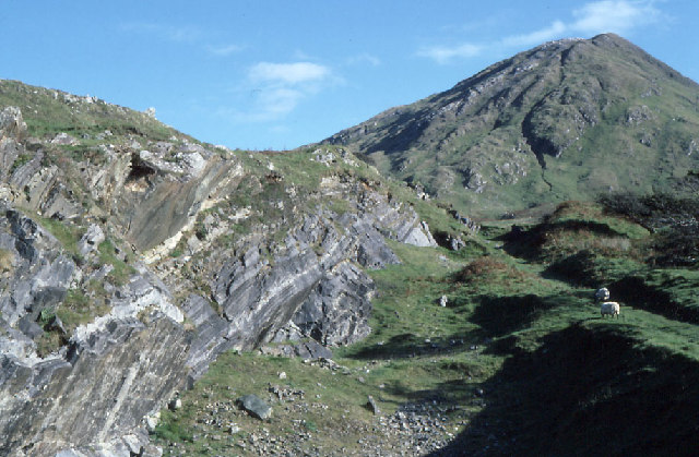
Diamond Hill, Connemara National Park, 3 km from Leitir Fraic, Galway, Republic of Ireland. Geographical data: photo taken at grid reference L7357 [Accurate to ~1000m]; WGS84: 53:33.1286N 9:54.5887W [53.55214,-9.90981] |
| Date | Image taken in October 1987 |
| Source | Geograph British Isles |
| Author | Dr. Charles Nelson |
| Permission (Reusing this file) |
Copyright information from https://www.geograph.org.uk/faq.php: "Images are licenced for re-use under a Creative Commons Licence, see licence details by viewing a full size image." |
| Object location | | View this and other nearby images on: OpenStreetMap |
|---|
_region:IE_&language=en)
Licensing

|
This image was taken from the Geograph project collection. See this photograph's page on the Geograph website for the photographer's contact details. The copyright on this image is owned by Dr. Charles Nelson and is licensed for reuse under the Creative Commons Attribution-ShareAlike 2.0 license.
|
This file is licensed under the Creative Commons Attribution-Share Alike 2.0 Generic license.
Attribution: Dr. Charles Nelson
- You are free:
- to share – to copy, distribute and transmit the work
- to remix – to adapt the work
- Under the following conditions:
- attribution – You must give appropriate credit, provide a link to the license, and indicate if changes were made. You may do so in any reasonable manner, but not in any way that suggests the licensor endorses you or your use.
- share alike – If you remix, transform, or build upon the material, you must distribute your contributions under the same or compatible license as the original.
File history
Click on a date/time to view the file as it appeared at that time.
| Date/Time | Thumbnail | Dimensions | User | Comment | |
|---|---|---|---|---|---|
| current | 13:22, 13 September 2006 | | 640 × 419 (113 KB) | Alnaschar | {{Information |Description = Diamond Hill, Connemara National Park, Republic of Ireland. Geographical data: photo taken at grid reference L7357 [Accurate to ~1000m]; WGS84: 53:33.1286N 9:54.5887W [53.55214,-9.90981] |Source = [http://www.geograph.org.uk/p |
File usage
The following page uses this file:
Global file usage
The following other wikis use this file:
- Usage on ca.wikipedia.org
- Usage on da.wikipedia.org
- Usage on de.wikivoyage.org
- Usage on en.wikipedia.org
- Usage on es.wikipedia.org
- Usage on fi.wikipedia.org
- Usage on fr.wikipedia.org
- Usage on fr.wikivoyage.org
- Usage on ga.wikipedia.org
- Usage on gl.wikipedia.org
- Usage on is.wikipedia.org
- Usage on it.wikipedia.org
- Usage on it.wikivoyage.org
- Usage on ja.wikipedia.org
- Usage on lt.wikipedia.org
- Usage on nl.wikipedia.org
- Usage on no.wikipedia.org
- Usage on pl.wikipedia.org
- Usage on pt.wikipedia.org
- Usage on sl.wikipedia.org
- Usage on sv.wikipedia.org
- Usage on uk.wikipedia.org
- Usage on vi.wikipedia.org
- Usage on www.wikidata.org