File:GTA regions map.png
Jump to navigation
Jump to search
Size of this preview: 720 × 600 pixels. Other resolutions: 288 × 240 pixels | 576 × 480 pixels | 922 × 768 pixels | 1,229 × 1,024 pixels | 2,344 × 1,953 pixels.
Original file (2,344 × 1,953 pixels, file size: 795 KB, MIME type: image/png)
This is a file from the Wikimedia Commons and may be used by other projects. Information from its description page there is shown below.
Commons is a freely licensed media file repository. |
Summary
| Description |
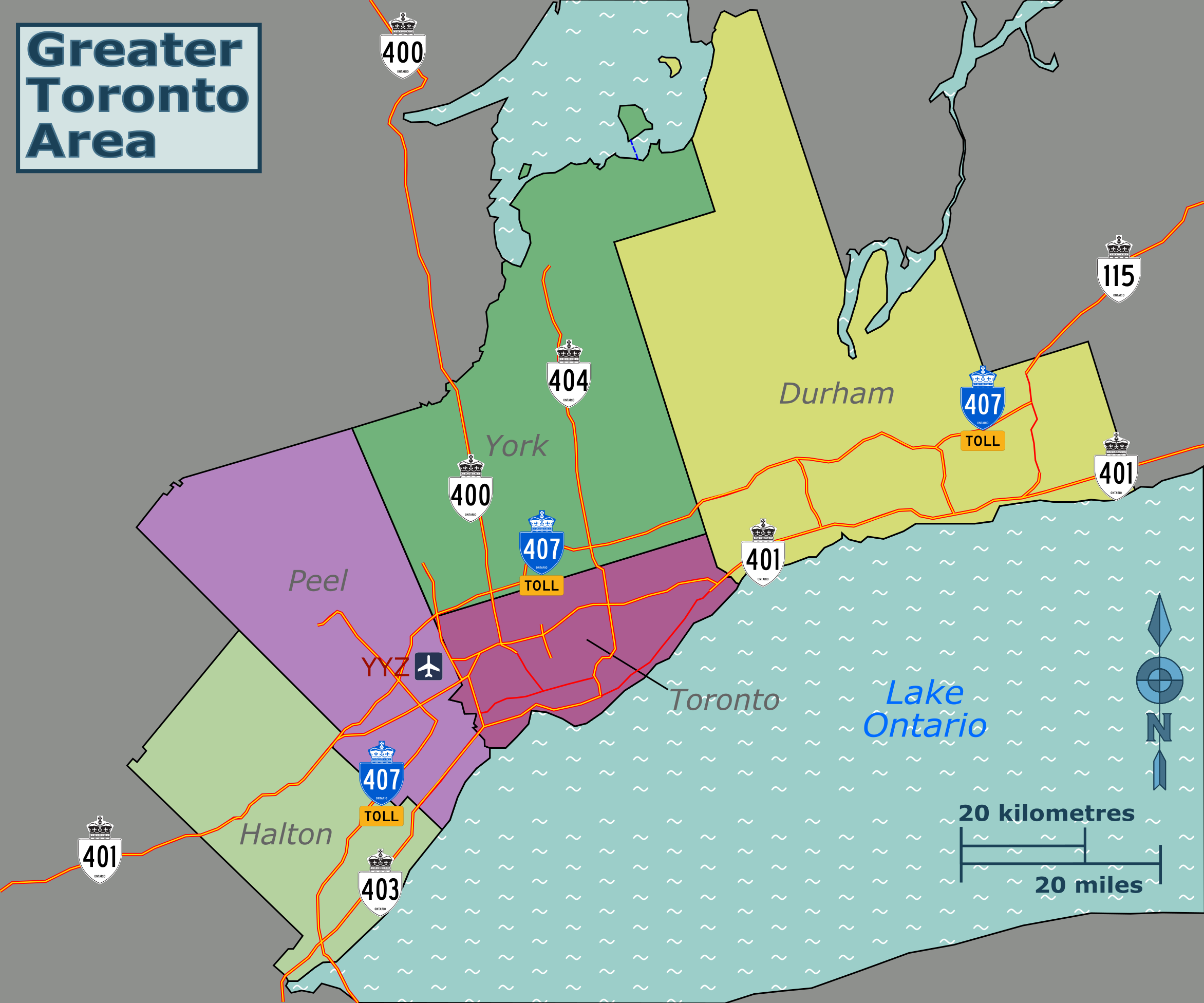
English: A map of the Greater Toronto Area for use on voy:Greater Toronto Area |
| Date | |
| Source | Own work, with outline based off OSM |
| Author | SHB2000 |
| Other versions | File:GTA regions map.svg |
Licensing
I, the copyright holder of this work, hereby publish it under the following license:
This file is licensed under the Creative Commons Attribution-Share Alike 4.0 International license.
- You are free:
- to share – to copy, distribute and transmit the work
- to remix – to adapt the work
- Under the following conditions:
- attribution – You must give appropriate credit, provide a link to the license, and indicate if changes were made. You may do so in any reasonable manner, but not in any way that suggests the licensor endorses you or your use.
- share alike – If you remix, transform, or build upon the material, you must distribute your contributions under the same or compatible license as the original.
File history
Click on a date/time to view the file as it appeared at that time.
| Date/Time | Thumbnail | Dimensions | User | Comment | |
|---|---|---|---|---|---|
| current | 12:23, 19 December 2022 | | 2,344 × 1,953 (795 KB) | SHB2000 | Uploaded own work with UploadWizard |
File usage
The following 2 pages use this file: